Mojave Desert
in Travel
16 October 2015
8:00pm: Change of Plans
Denver International Airport (DEN)
We’re watching video footage of a highway full of cars being thrashed around by a mudslide several feet thick. The video is taken from inside one of the cars, and the panic in the driver’s voice is chilling. All Heather can manage to say is “whoa”.
Maybe we picked the wrong week to come out to the desert.
As we sit in the Denver airport waiting for our connecting flight, we start listing the other parks in the region and check their weather forecasts. Our original plan was to spend a few days backpacking in southwestern Utah, but the weather forecast calls for thunderstorms and heavy rain, and flash floods are going off all over the region.
Tonight, we stay in Las Vegas, but after that have no idea where we’re headed.
11:00pm: Advice About Water
McCarran Rent-A-Car Center
“We do have street flooding around here, so if you see a bunch of standing water, avoid it at all costs. We’ve had cars get swept away and people drown.”
The car rental agent tears off the carbon sheet from the inspection report and hands our paperwork back to us.
“Be careful out there.”
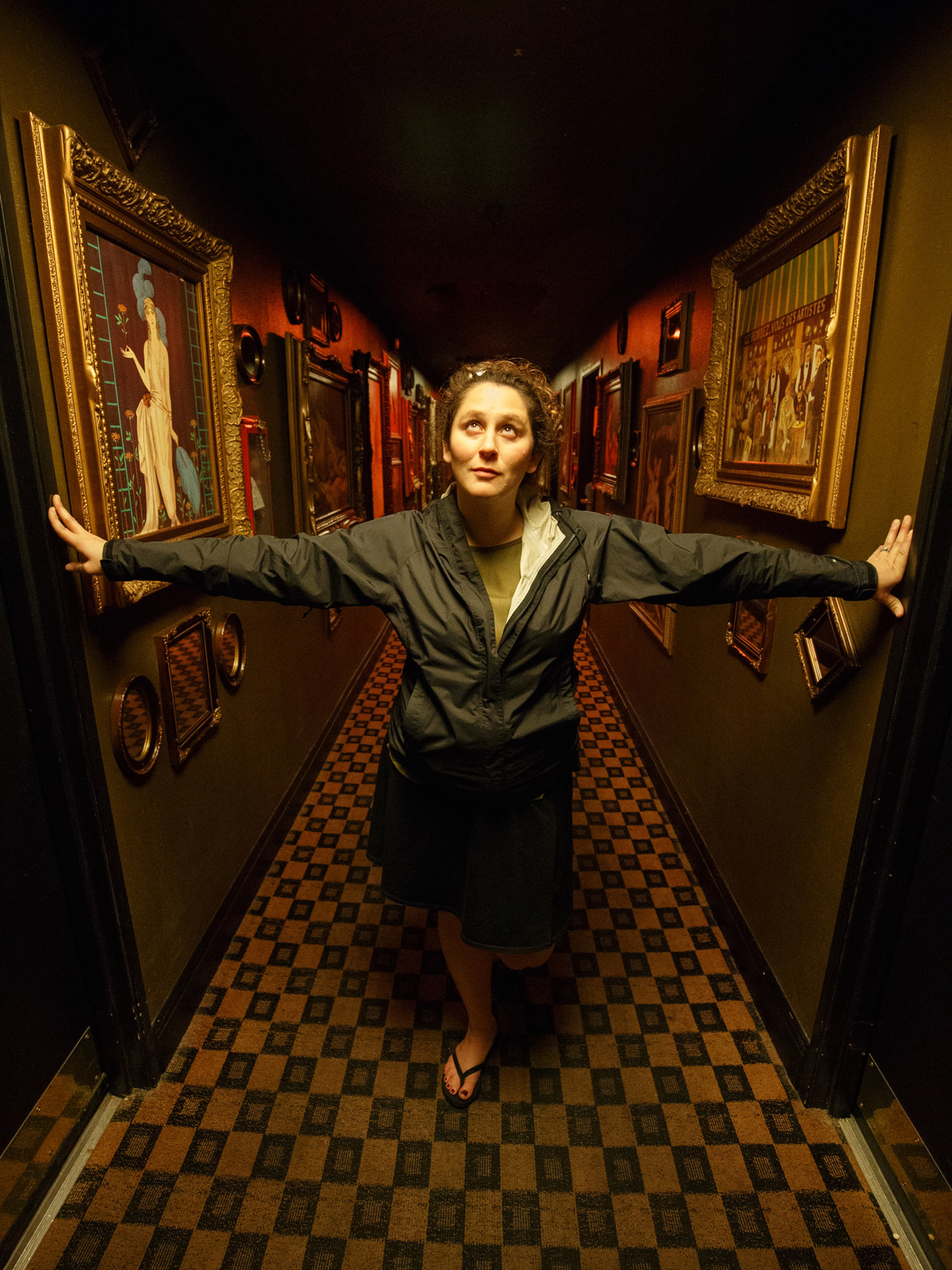
11:30pm: Don’t Mind the Nightclubbing
Artisan Hotel Boutique and Lounge
“We have a nightclub that operates until about 7am, so it could get quite loud in your room. By initialing here, you agree that you won’t seek a refund in case of noise.”
“When does it open?” Adam asks, as he signs the waiver.
“Midnight,” the clerk replies. It’s 11:48pm.
We’ve been warned about a lot of things today. But this hotel, which we booked last-minute, has made the night interesting. It bills itself as “Gothic-Chic” and is painted red, purple, and black. Dark bronze sculptures pack the lobby, and nearly every yard of wall and ceiling has a painting attached to it. Heavily tattooed bar patrons dressed in black leather and latex form a steady stream from the bar to the smoking area outside.
If we weren’t so tired, we’d stay up for the party.
17 October 2015
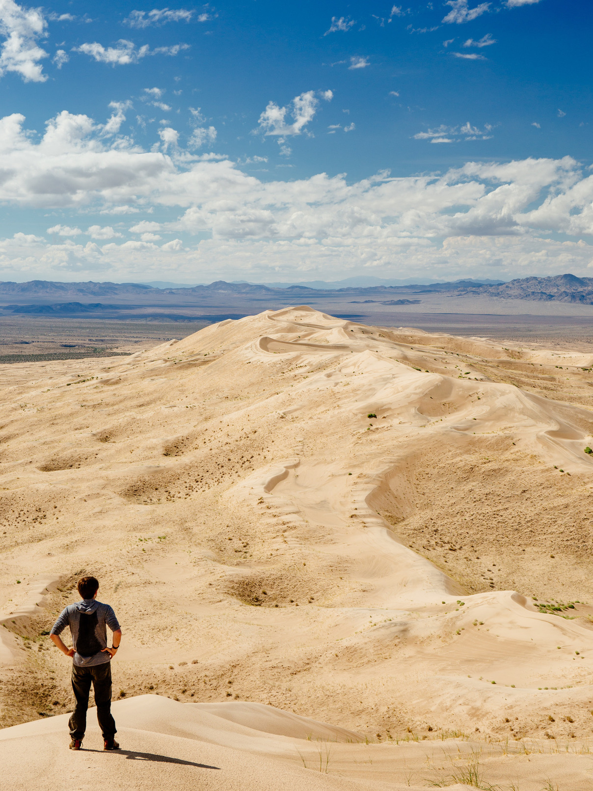
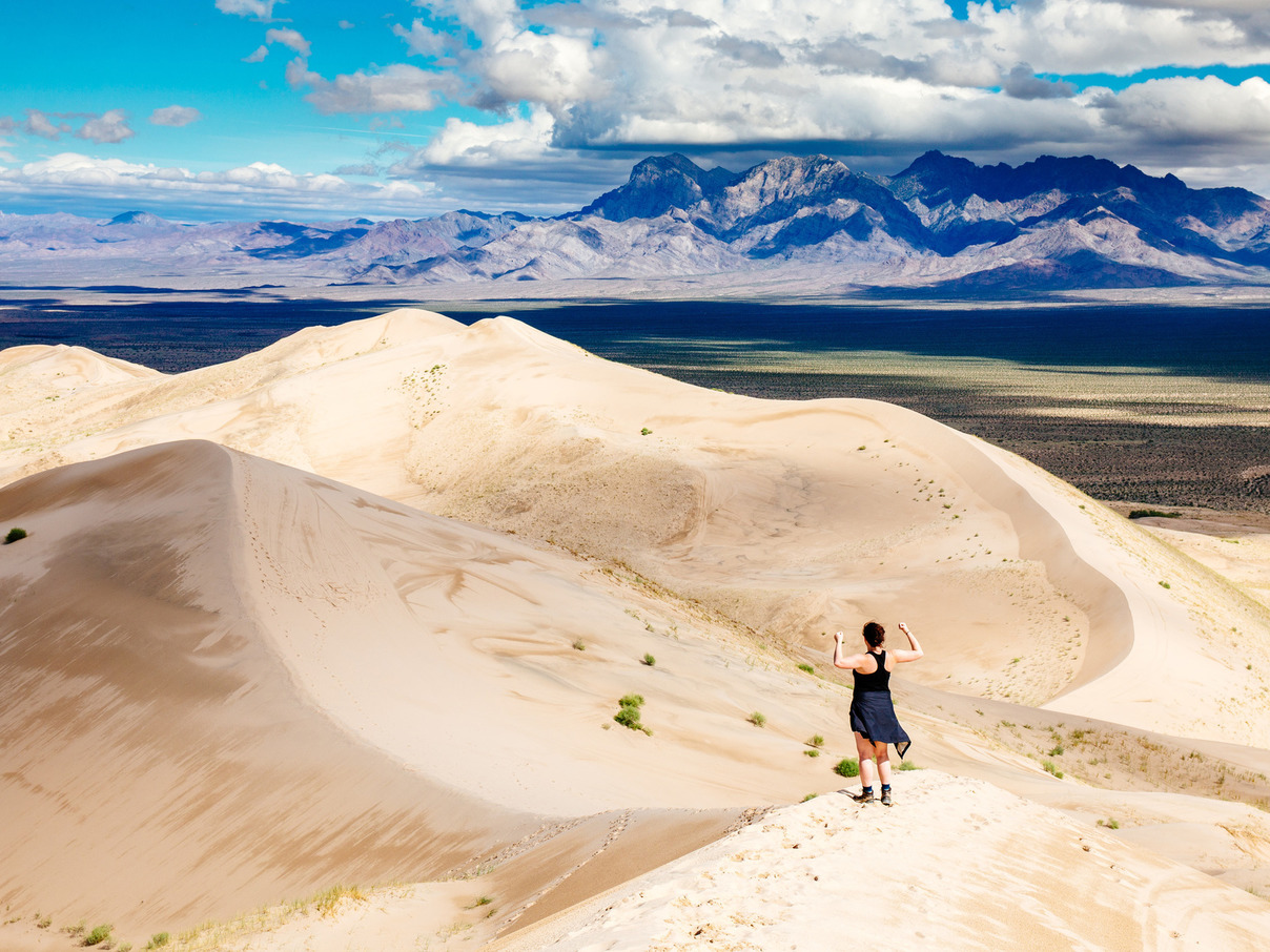
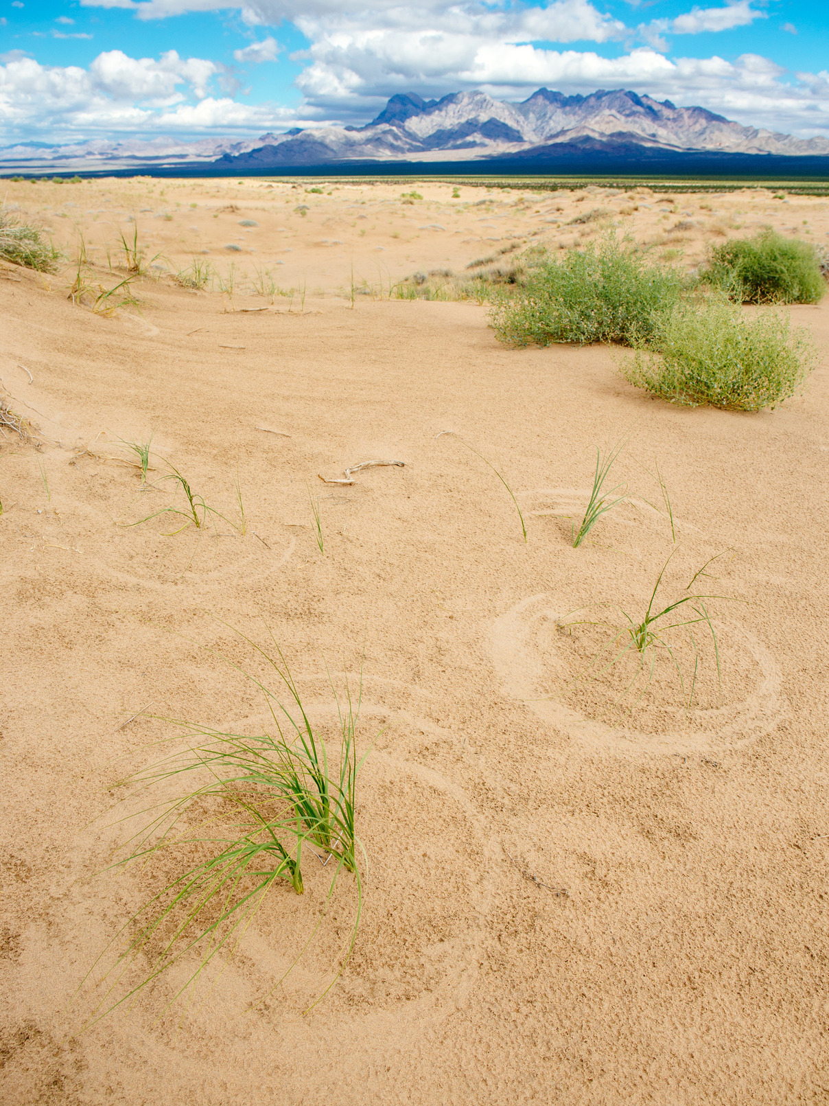
1:30pm: Dunes of the Mojave
Kelso Dunes
The Kelso Dunes are among only a handful of dunes worldwide known to “boom”. The shifting sand, sliding down the slopes of the dunes, causes the dune to resonate, like an instrument. The low, rumbling sound resembles distant thunder.
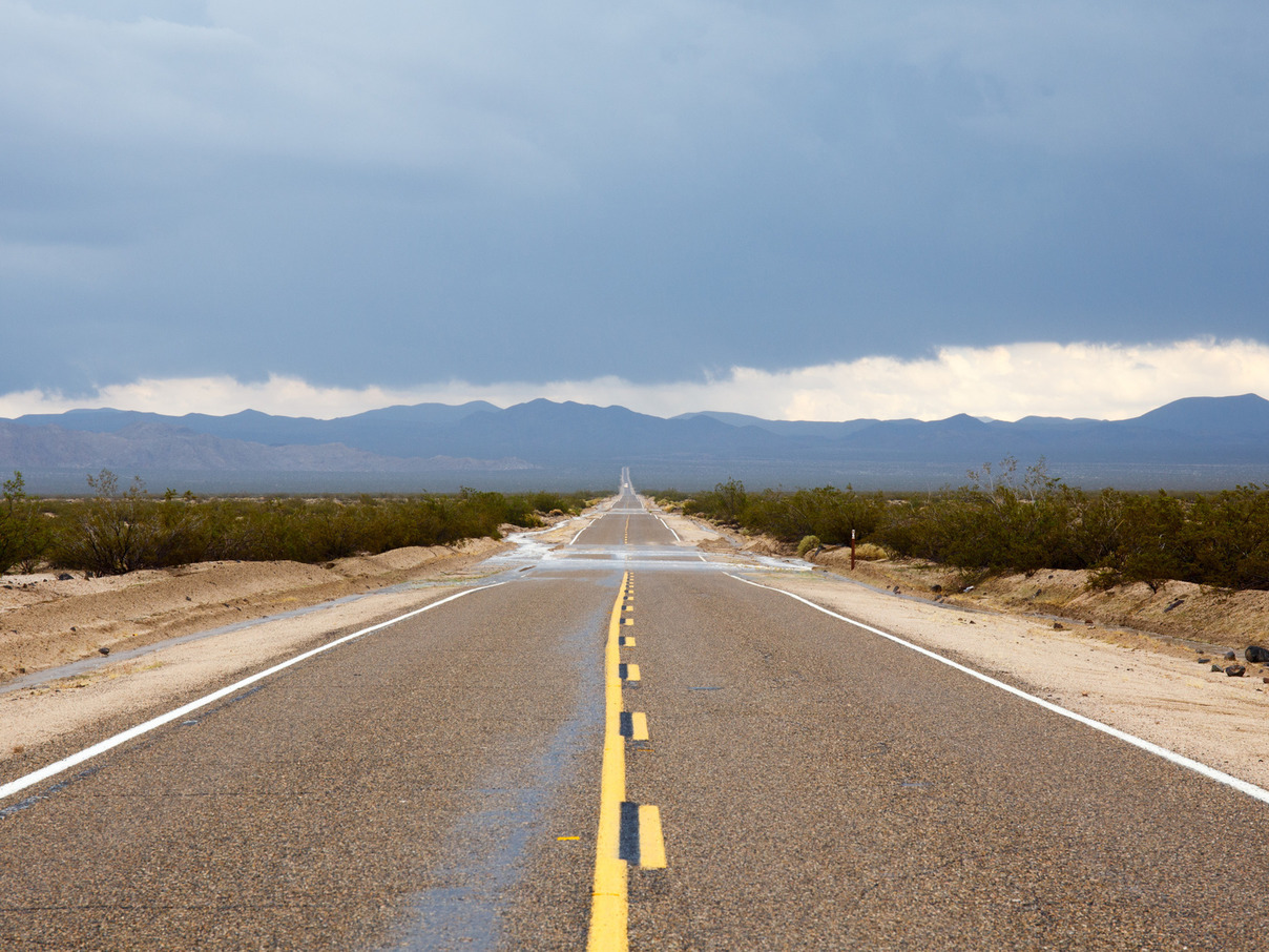
After checking the weather again this morning, we decide to head down to Joshua Tree National Park in southeastern California. The route down from Las Vegas takes us through the Mojave desert. It’s a beautiful, white desert, and a forest of Joshua trees lines the road. Occasionally the lower sections of the road are filled with mud from recent flash flooding.
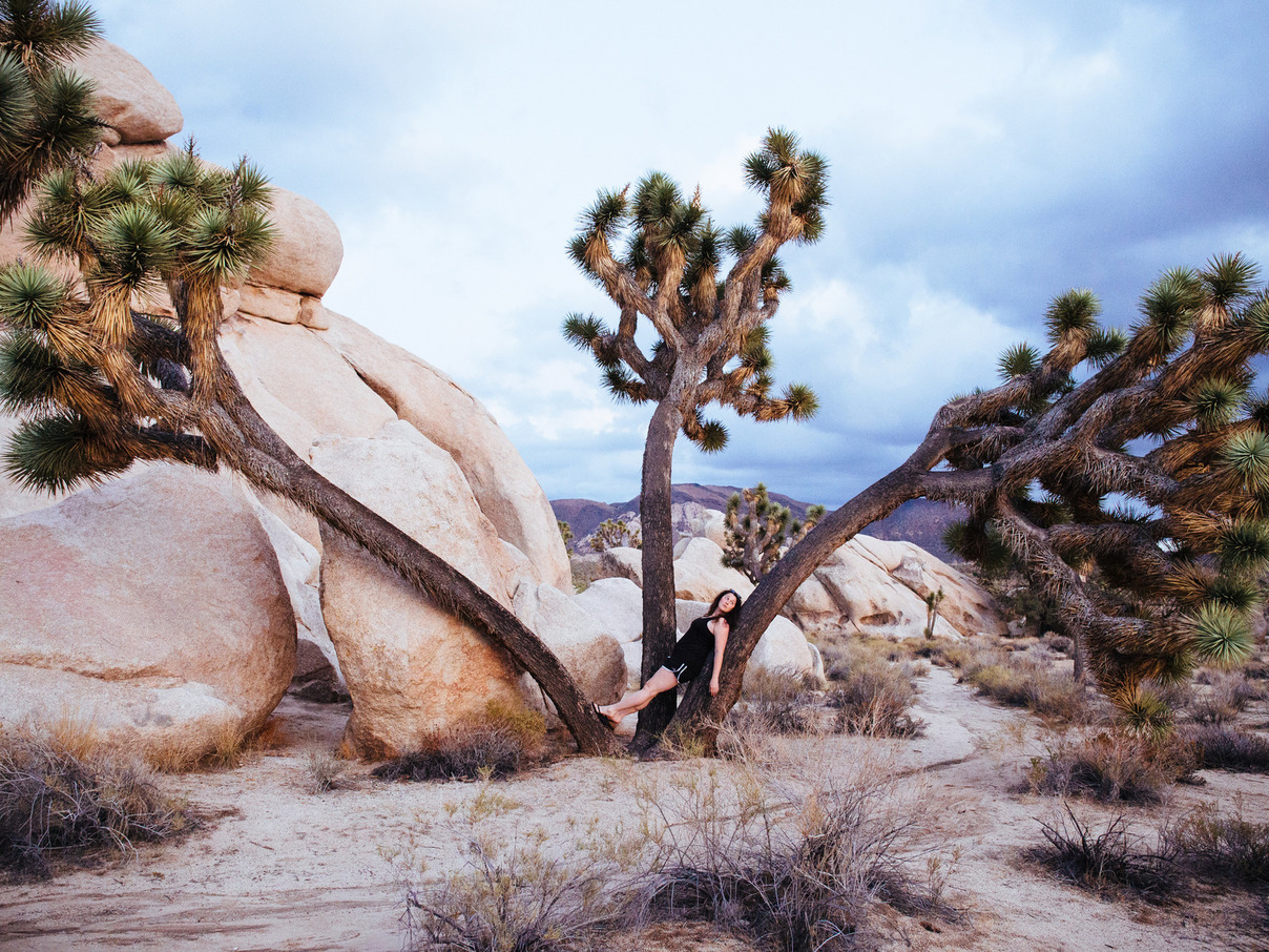
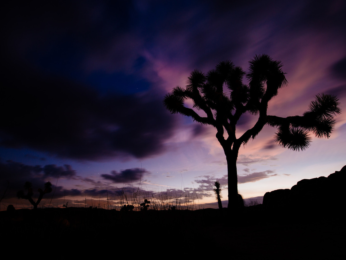
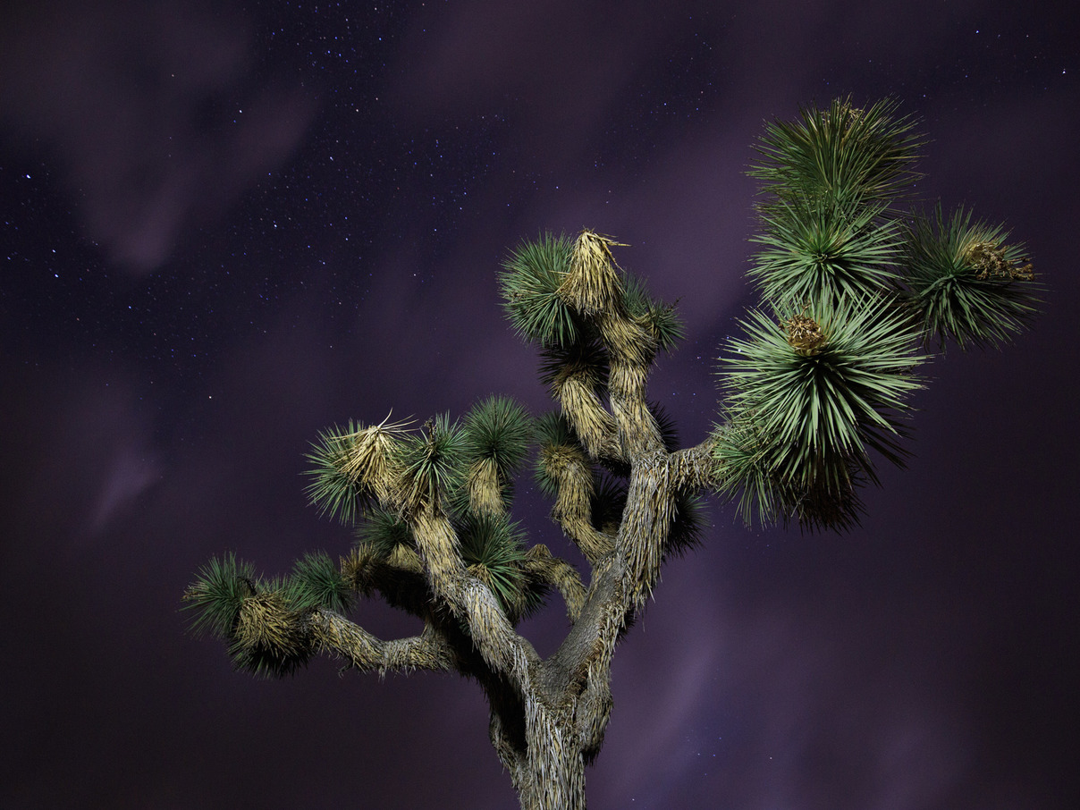
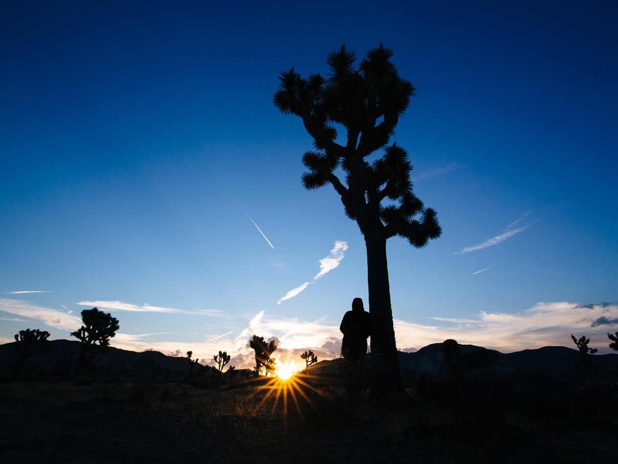
5:00pm: Joshua Tree Sunset
Joshua Tree National Park
The ranger stands for a moment, thinking.
“The best place for tonight’s sunset? I would go on in, and drive up to the Hidden Valley picnic area. There’s an open view to the west, and from that spot you can just walk out into the open field.”
His advice is dead on. The field is thick with Joshua trees, their curved and gnarly silhouettes standing out against the horizon. Granite rock formations stand tall among them, and a quick scramble up the boulders earns us a great vista.
As the sun sets behind the mountains, small armies of photographers wade into the field with their tripods, intervalometers, and red headlamps. The desert is still and quiet, and although the sky isn’t especially clear, the comfortable temperature makes for a great night.
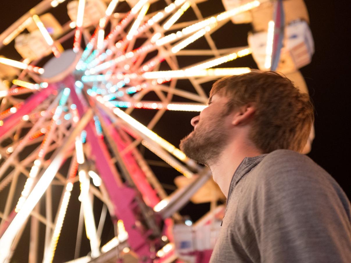
10:00pm: Pioneer Days in Twentynine Palms
Luckie Park
The Gravitron. The Scrambler. The Himalayan. Shouts and music fill the air.
We stumble on the Pioneer Days fair completely by accident. The bright lights of the park catch our attention while we’re driving to our campground. We grab a delicious, authentic burrito from a food stand and stroll through the carnival grounds for a while. It brings on a wave of nostalgia for the rural fairs we went to as children.
18 October 2015
7:00am: Alone at Sunrise
Joshua Tree National Park
After the fair, we got to our campground so late that we didn’t feel like pitching the tent, so we just cracked the car windows and slept in our seats.
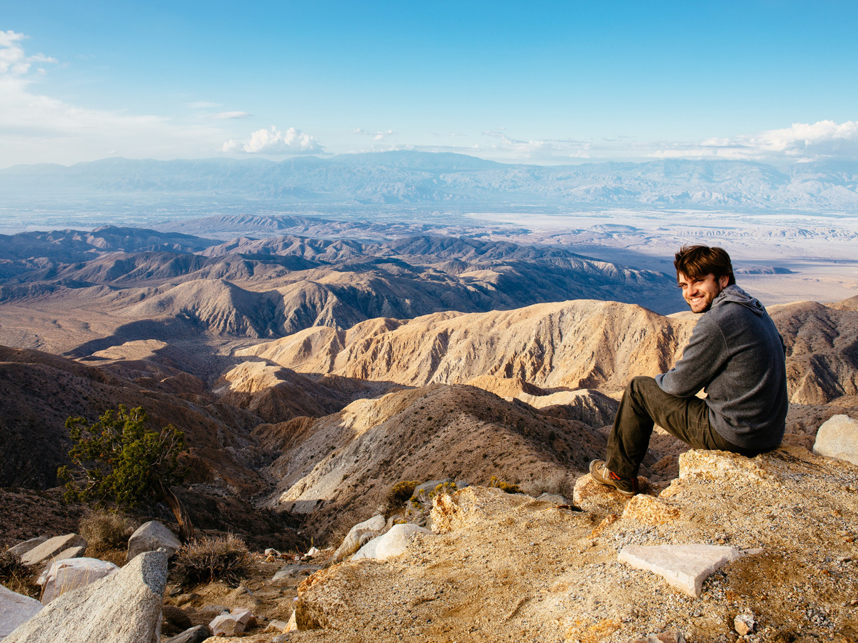
This morning we wake up before dawn and head into the park before the crowds and temperatures crank up. We’re the only souls at Keys View, a lookout point in the southern part of the park that towers over the Coachella Valley, with a view stretching from Palm Springs to the Salton Sea.
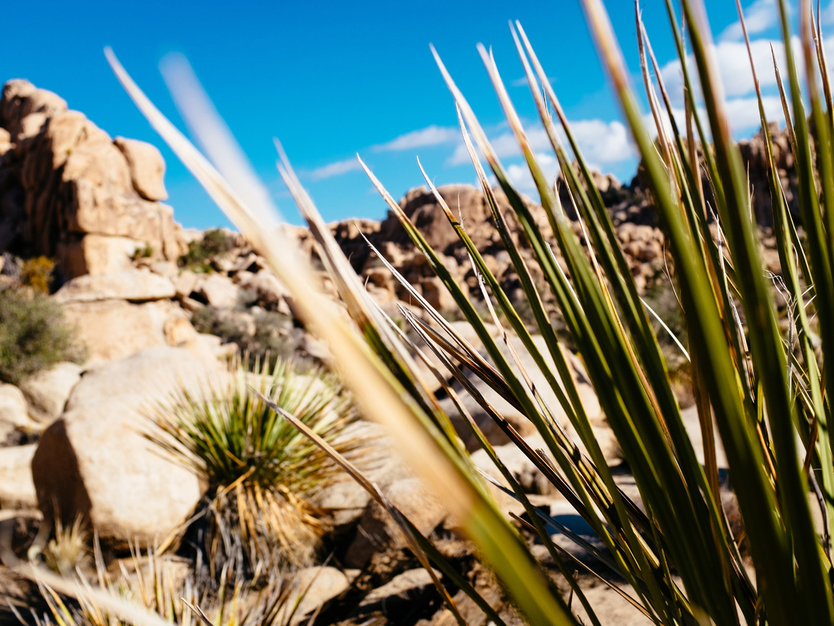
10:00am: Hidden Valley
Joshua Tree National Park
Yesterday we heard that there was a big climbing event happening in Joshua Tree this weekend, with pros on hand to guide and teach amateur climbers. This morning we see proof of its popularity: seemingly every rock formation in the park has climbers scaling its flank, and most have triumphant climbers standing on top.
Hidden Valley is well-named, an enclosed circle ringed by rock formations, and legend holds that it was once used to hide stolen cattle. It’s clearly popular with climbers, as we pass more groups with helmets, ropes, and harnesses than we do hikers.
After a spin around the valley, we head into town for lunch, and then make our way north to our next park: Death Valley.
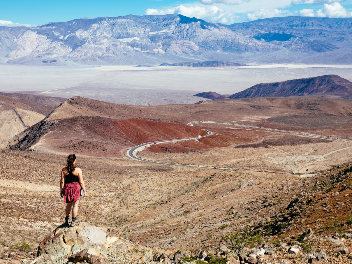
3:00pm: Volcanoes and Looming Flash Floods
Mojave National Preserve
The road north is desolate. There are stretches of up to 50 miles without any signs of civilization aside from the road and long lines of electrical wires. Dark clouds surround us and extend all the way to to the horizon, immersing us in a strange blue-and-brown duotone landscape.
The signs of recent and looming flash flooding are all around: the washouts at the sides of the road are swollen with dark brown water, which crosses the road in narrow, deep, and rapid streams at each dip in the pavement.
The road passes through tens of miles of volcanic craters and ancient lava fields, which comes as a surprise. We didn’t know that this area had been the site of so much volcanic activity, and we resolve to come back and explore them someday.
4:00pm: Drier, Hotter, Deeper
Death Valley National Park
As we approach Death Valley, the road steadily slopes down. We descend several thousand feet in less than an hour, pressure constantly building up in our ears. The air outside is noticeably warmer, and the vegetation becomes more sparse.
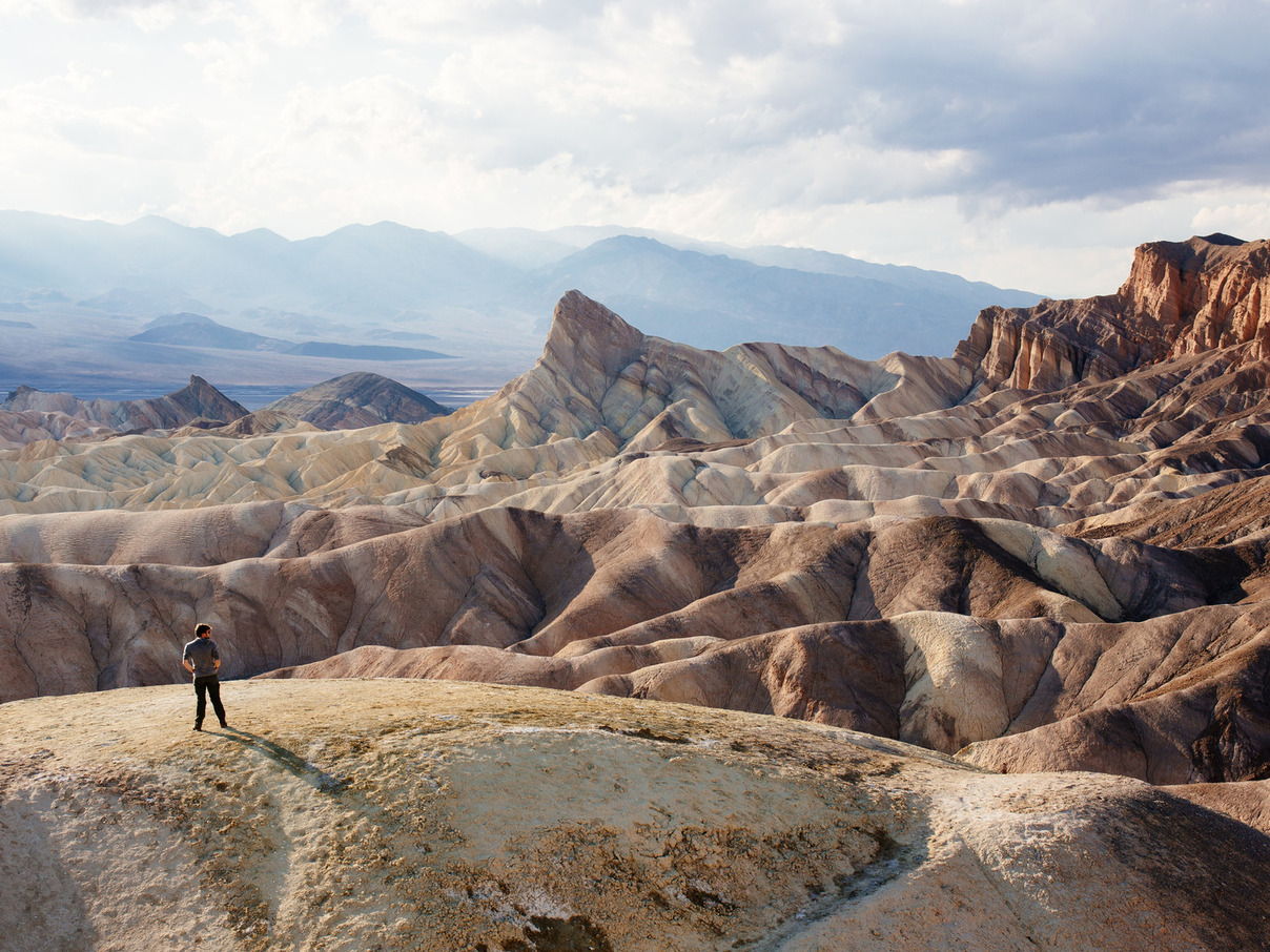
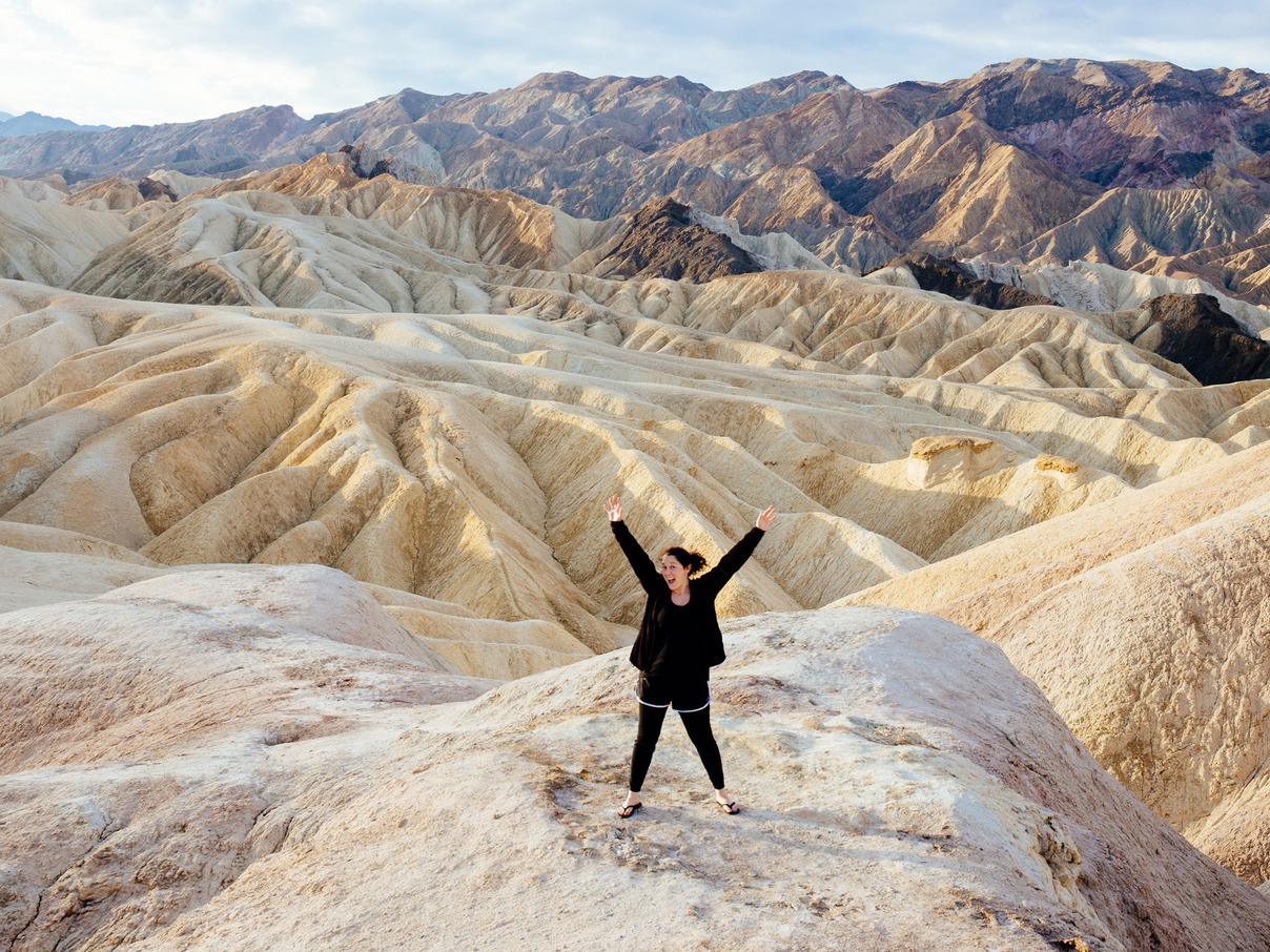
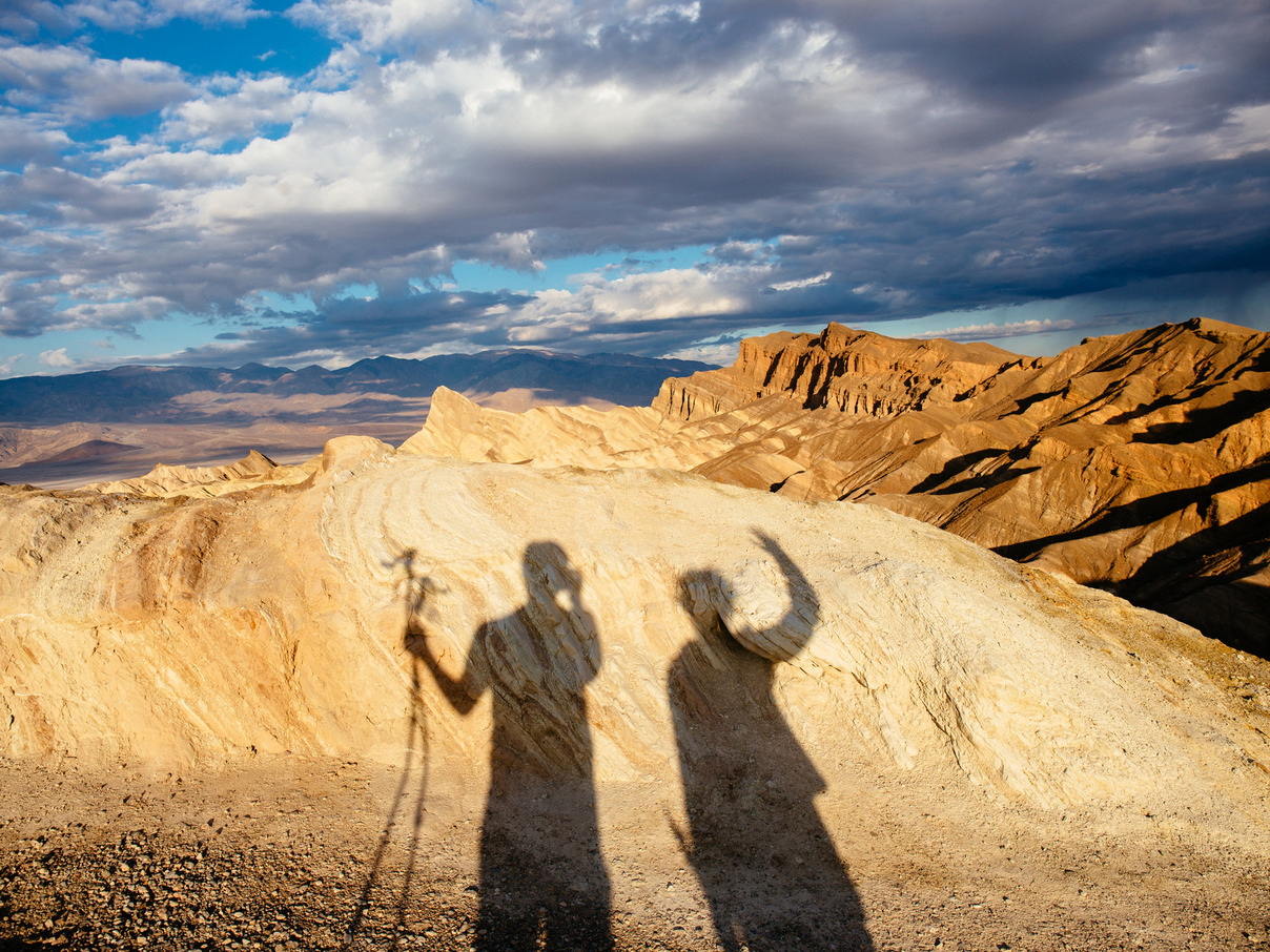
The road slopes even more steeply downward after we enter the park. A packed parking lot to our left captures our attention, and we pull in to check out Zabriskie Point.
A huge variety of desert landscapes are visible from here. Golden hills surround the point, their sides deeply eroded to form sharp fingers of dirt. Cliffs of red sandstone jut skyward from their upper reaches, and sharply-angled formations stand at the lower end of the area. Behind those formations is the miles-wide salt flats of Badwater Basin, the lowest point in North America and the hottest place on earth. Just beyond, the Panamint Range rises to 11,000 feet.
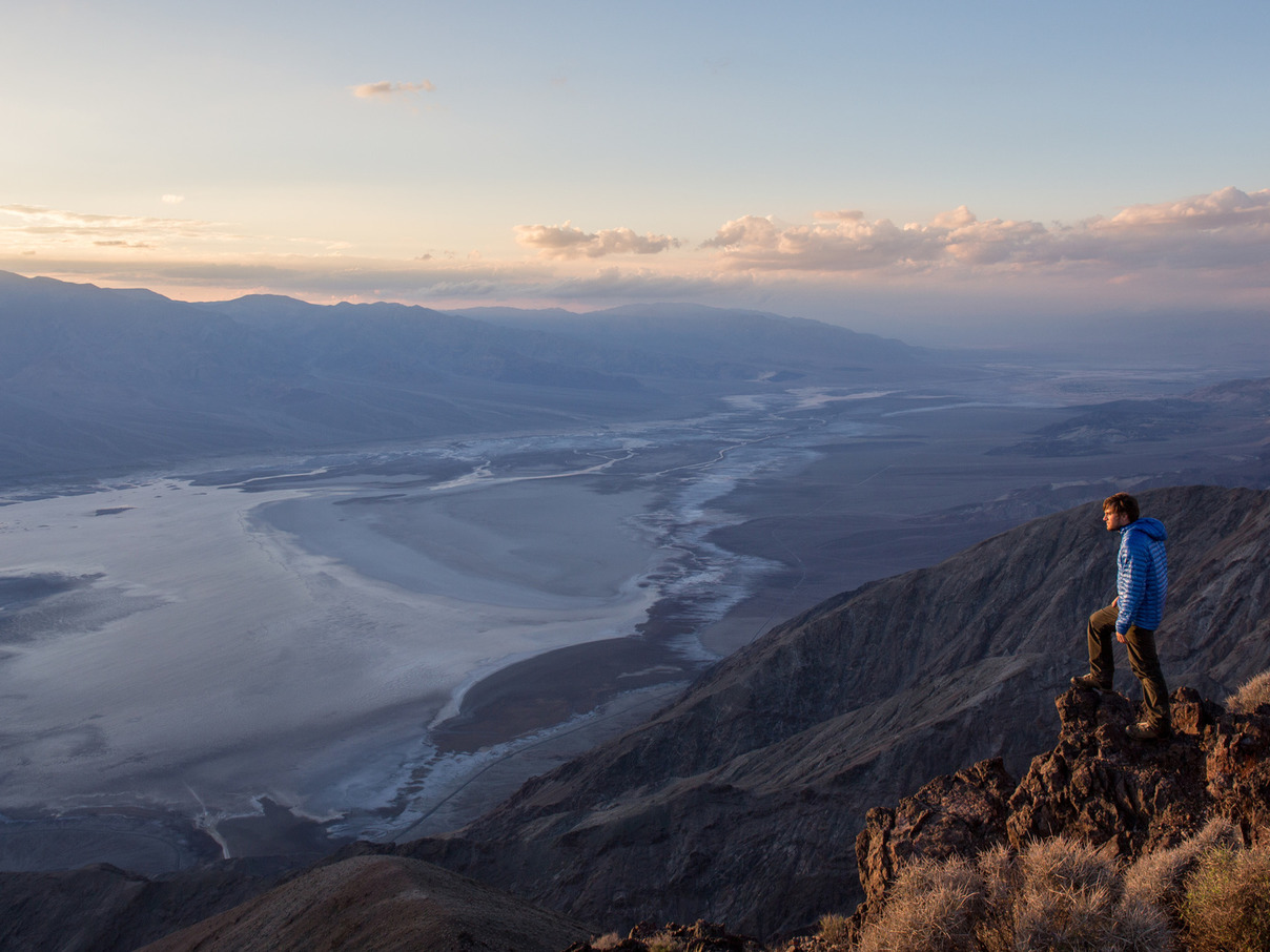
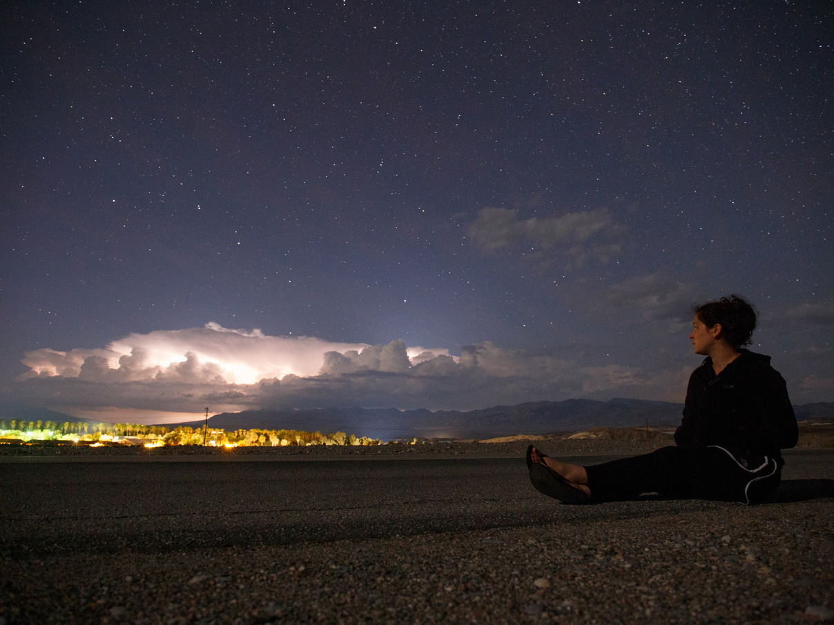
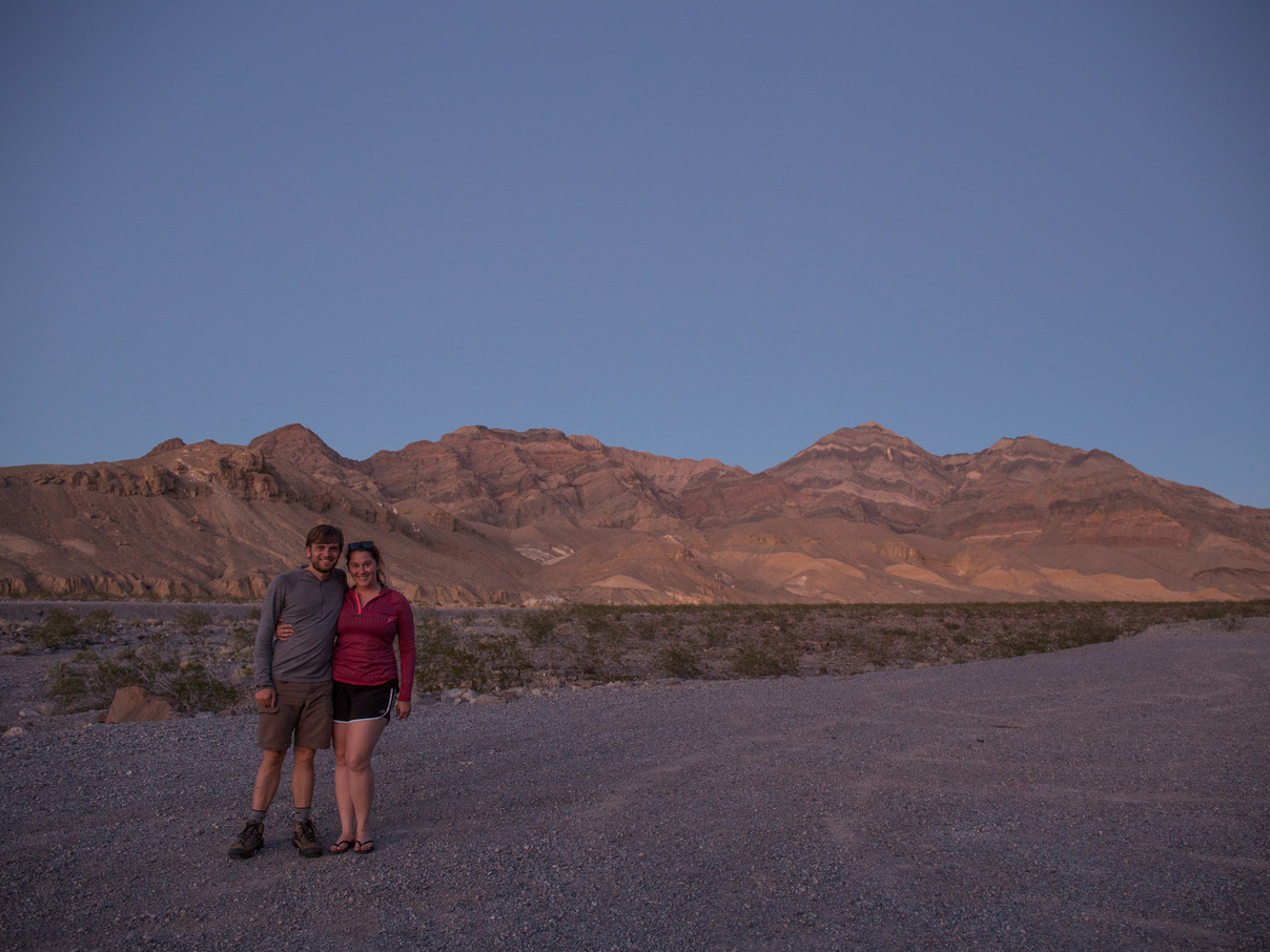
6:30pm: Dante’s View
Death Valley National Park
5,700 feet above Badwater Basin is Dante’s View, a popular overlook on Coffin Peak. The road to the top starts near the basin and is only 13 miles long, and the air pressure change is extreme. Atop the lookout, a cold and steady wind blows from the south. Most of the visitors here are dressed in shorts and t-shirts, and shiver as they run from point to point. Since we originally planned to camp in the high desert of Utah, we’re prepared with coats and warm pants.
After wandering the ridge for a while, we settle in the shelter of a rock outcropping to watch the sun set over the valley. In the distant north, a thunderstorm unleashes a steady torrent of lightning bolts. There’s probably a lot of flooding going on up there, and we hope that it doesn’t keep us from exploring more of the park tomorrow.
19 October 2015
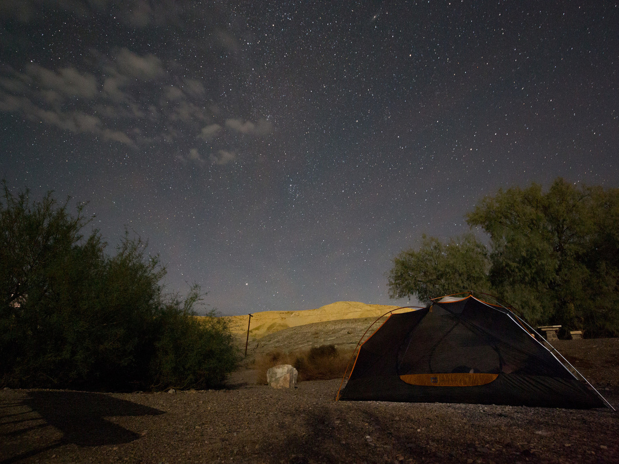
3:00am: Coyotes
Death Valley National Park
The piercing howl of a coyote startles us awake. His voice is so vividly clear that he must be within our campground. The moon is long gone, and in the still air his howl is all-consuming.
We lift our heads to look around and begin to hear distant replies. One group seems to be further west in the valley, near the visitor’s center and the RV campground. We listen to their back-and-forth dialog for a few minutes when another howl comes suddenly from our side of the valley. After a few more minutes, the howling stops abruptly.
Once our ears adjust, we can hear his footsteps as he walks around the campground. In this silent area, every sound is crisp, and we hear a twig snap in the next campsite. Our coyote is making a whimpering sound, and is soon joined by another. The second coyote from further up our side of the valley is here, and they sound like they’re circling each other in our neighbor’s campsite.
After a few nervous seconds, one of the campers shouts, and the coyotes sprint from the campground.
As the sound of their running recedes, flashlights from tents all around the campground scan the area, and we can hear murmurs of conversation from the other tents. After it appears that they’ve gone for good, the movement settles and the area falls into complete silence again.
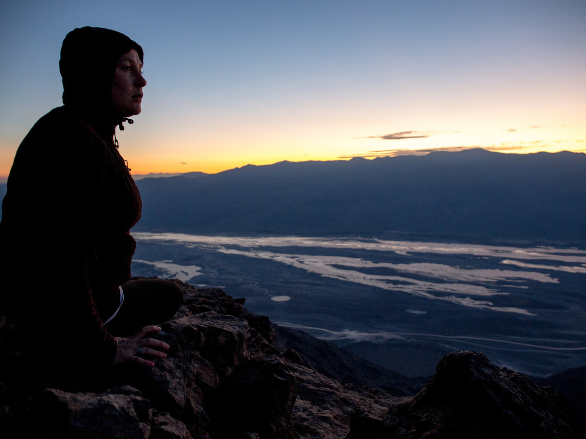
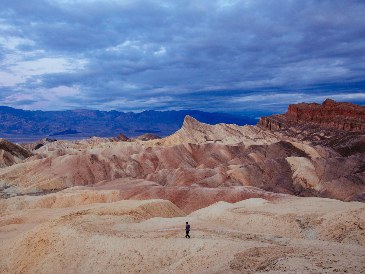
7:00am: Zabriskie Point Sunrise
Death Valley National Park
This lookout was so captivating that we decide to return for sunrise. As we unpack our cameras from the car in the pitch-black parking lot, we can see a group of people entering a side trail by flashlight. Here in Death Valley, you have to do your hiking in the morning while temperatures are cooler.
As we set up a tripod at the overlook, we see the group emerge on top of one of the golden hills, where they drop their backpacks and pull out tripods of their own. It turns out that Zabriskie Point is a popular photography spot at sunrise, and we feel validated in our choice. Even though they’re at least a half-mile away, we can clearly hear their conversations. One of them must be named Barbara.
As we’re leaving, we’re startled by a loud rustling and squeaking sound overhead. It’s a raven, and in this otherwise-silent desert we can plainly hear its breathing as it makes its way up the valley.
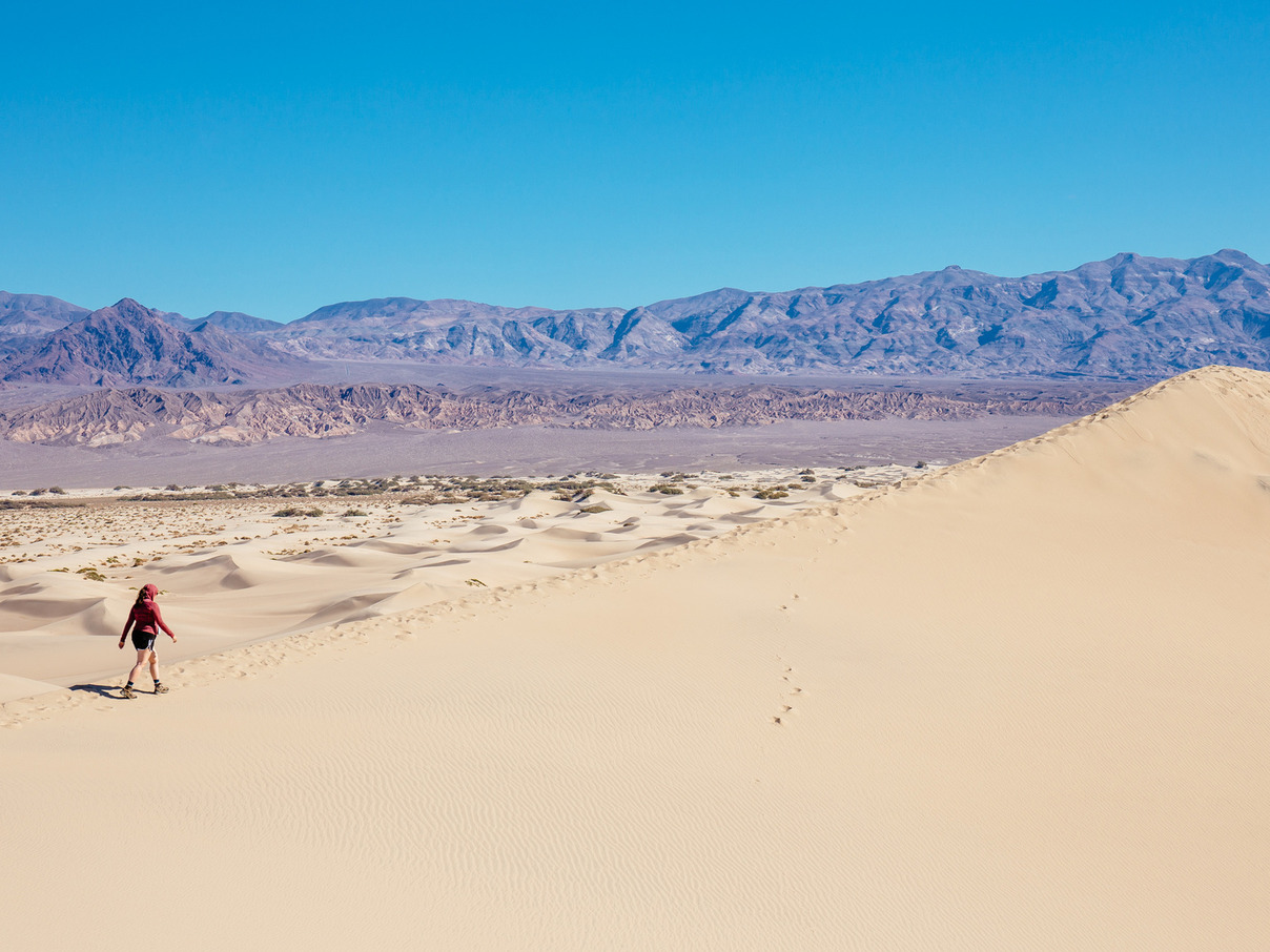
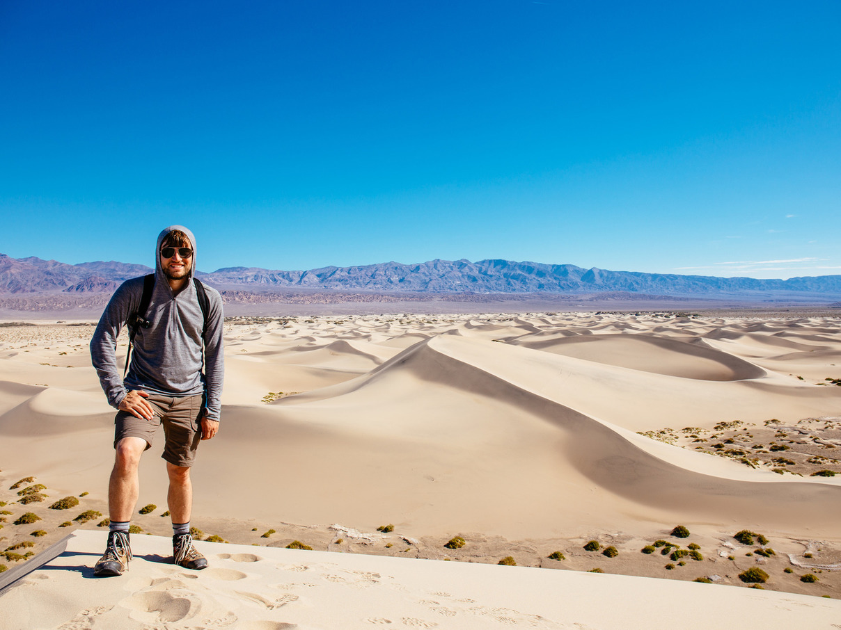
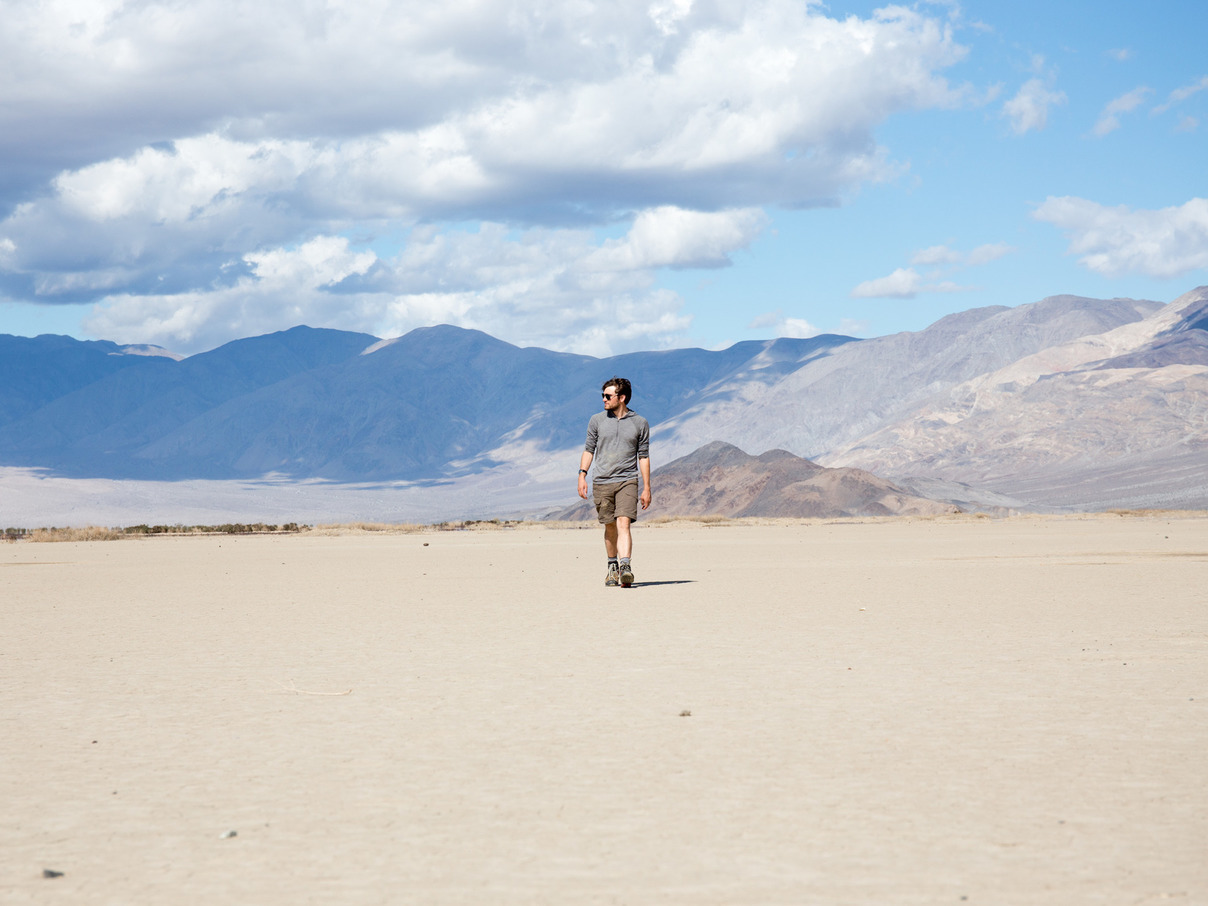
10:00am: Mesquite Dunes
Death Valley National Park
“EXTREME HEAT DANGER,” reads the red STOP sign at the trailhead. “Hiking the dunes is not recommended after 10am.”
It’s 9:45 and feels like a mild morning, and we decide to give it a shot.
Death Valley is huge, and distances are deceiving. We head towards the tallest dunes in the formation, and they don’t approach as quickly as we had expected. We finally reach them just as we empty the first of our two water bottles. A merciful breeze provides some relief, but we can feel the area heating up rapidly. Fortunately, descending the dunes on the way back is much easier, and we return just as it becomes uncomfortably hot.
It’s not even noon yet.
2:00pm: Panamint Valley
Death Valley National Park
The Panamint Valley lies east of Death Valley, separated by the Panamint Range. At its heart is a salt flat that stretches for miles and miles.
With the temperatures rising rapidly, we’re spending the afternoon sightseeing from the comfort of the car.
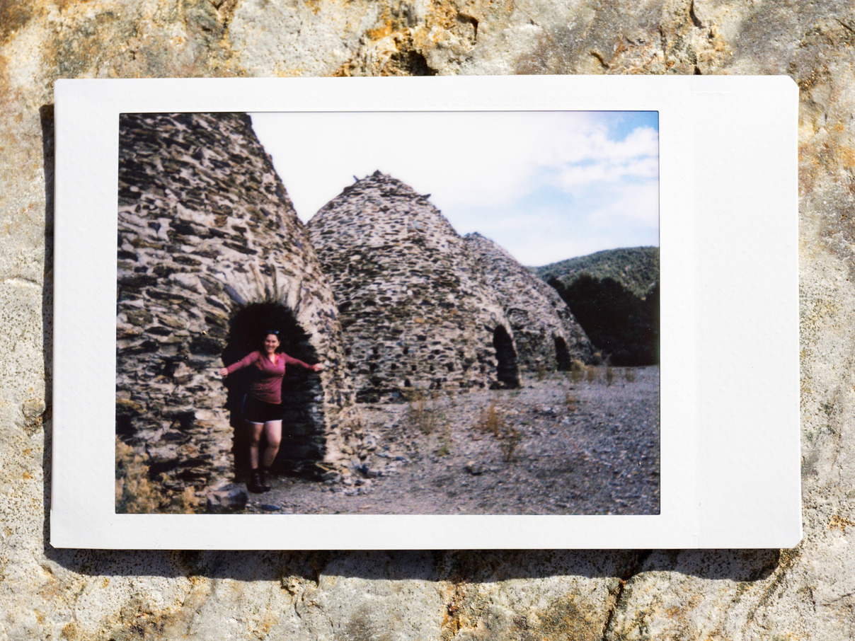
4:00pm: Wildrose Charcoal Kilns
Death Valley National Park
With the temperatures now getting too high to even enjoy from the car, we head for the peaks of the Panamint Range. As we gain altitude, the vegetation changes, and after an hour we’re in a grove of Pinion Pine trees. The temperatures here are cool, and at the end of a rough dirt road we come upon the Wildrose Charcoal Kilns.
Built in 1877, these beehive-shaped kilns were used to turn Pinion Pines into charcoal for powering a mining company’s lead-silver smelters. Although they were only used for a couple of years, they’ve been restored twice in their lifetime and are in remarkable condition. Their interiors still smell strongly of smoke after 136 years.
The road continues up to the Mahogany Flat campground at 8,133 feet, but it’s too rough for our little Ford compact. After enjoying the cool mountain breeze for a while, we head back down into the valley. We only pass a handful of cars on the way.
5:30pm: Unknown
Mercury, Nevada
“There’s some kind of underground nuclear waste fire. The interstate is closed for a few days. And the road to Furnace Creek is closed with flooding,” says the waitress at the Stovepipe Wells Saloon.
After hearing this, we start asking for news around other parts of the park. In remote places like this, news travels unreliably.
After traveling east to Furnace Creek without incident, invalidating the waitress’ advice, we ask for news from a ranger.
“The major highways are closed,” she replies, “so the only way to Las Vegas is to go out the west side of the park and down to Highway 395.”
That would mean backtracking all the way back through the park, but we’ve grown skeptical. We ask the clerk at the gas station next door.
“Oh yes,” he replies, “the way from Beatty just opened up, so you can get to Las Vegas that way. I just heard about it a few minutes ago.”
Getting to Beatty requires backtracking halfway though the park and taking a long detour to the north, so we walk over to the reception desk of the resort nearby.
“We just heard an hour ago that the only way to get to Las Vegas is by exiting the southeastern end of the park, detouring north to Amargosa Valley, and taking Highway 95 east from there.”
Every single piece of advice that we’ve received has been contradictory. But because this last one is the most convenient, we decide to roll the dice.
In many sections, the road is covered with dirt left by the recent flash-flooding, and it kicks up into a cloudy haze whenever a car passes us. But aside from this, we make our way back to Vegas without incident.
20 October 2015
9:00am: Leaving Las Vegas
After arriving at the Rio late last night, we grabbed a big dinner and spent some time among the slot machines. The bright lights and musical chirps are energizing, but we finally give up the ghost around midnight, completely exhausted from the day.
We didn’t expect to come to the Mojave on this trip, but it has captured our hearts with its beauty and scale. The desert is high-definition. Every sight and sound is crisp and full of contrast, and the power of nature here is undeniable. It engages all of your senses and requires vigilant attention to your surroundings and physical condition. It brings you fiercely to life.
We’ll be back.